So, I compiled a book titled "Rain and River" for the Cass Co. Historical Society, using photos - post card images taken by the 4 photography studios in town at the time of the event - and material, such as eye witness accounts and newspaper accounts saved within the collection.
I ran across the folder, containing those images used in that book, on my computer screen today. I decided to share some of the good images here. There are many, many, MANY more - too many to share here. But I believe this is a good sampling. I hope you will agree.
The flood hit the mid-west. Logansport's disaster date was March 21, 1913. I will include an account that I wrote for the Cass County Historical Society, back in about 2006.

Third Street Bridge over the Wabash looking north toward town from Biddle Island.

Same view after the bridge is swept away.

Same view, different angle, bridge swept away, but water now subsiding.


View from Biddle Island, notice the snow on the roofline. Yes, after the water rose and flooded the area, Mother Nature decided to add a little snow.


The yellow line was drawn on this postcard image to show just how high the
water was before finally subsiding.

Above is the back of that postcard, explaining the drawn line.

Above and below - homes on Logansport's south/southwest side.
The area known as "Shultztown" was hit the hardest.

People were cutting holes in their ceilings to access their roof where
they'd call out for help. Some even fired guns to get rescuers' attention.


"Naval Students from Chicago" rescue boat on west side of Logansport.
The larger group of rescue boats came from Culver Academy, about 45
miles north of Logansport in Culver, Indiana.


Here is a "Culver" boat. At the time I compiled the book I was told that boat
No. 13 was still around. These young men of Culver Academy could
rescue because they had been taught the skills and the discipline required to do so.


Swirling flood waters on E. Market Street.


The image above was also published in the photo book "Where Two Rivers Meet",
another long-time best seller book by the CCHS.


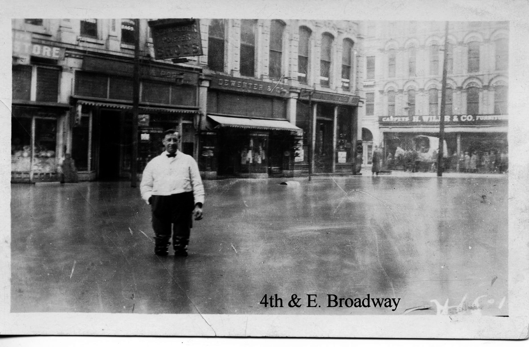
Above photo was taken on E. Market Street.

The photo above was taken standing (or boating) on E. Market and 4th, looking
south toward the Pennsylvania RR Depot. The depot was torn down in the 1960s.

E. Market and 4th Street.

4th Street looking north. The courthouse is at left as indicated with text, the
former Masonic Temple (still stands and is apartments).


The Barnett Hotel stood in the 200 block of E. Market. It was the "new" Barnett
and shouldn't be confused with the original "old" Barnett, which stood on
the other side of the street on the southwest corner of 3rd and E. Market.
Notice the people on the upper balconies.


Above photo shows damage inside a downtown business, as the water is subsiding.

West side homes.

Train at the Pennsylvania Depot.


Interurban tracks, washed into the river.

This was taken after the waters subsided.
The back, or south side, of the Pennsylvania Depot is at right (above).
The small building at left was washed down from upstream.

Melbourne St. at 5th St. looking west. Amelio's (now called Amelio's By The River)
can be seen on the corner. The business displays the high water mark to this day.


Accessing the damage and in awe of what happened - these people stand at E. Market and 5th.


People stand outside Harrington Photography studio on 5th Street.
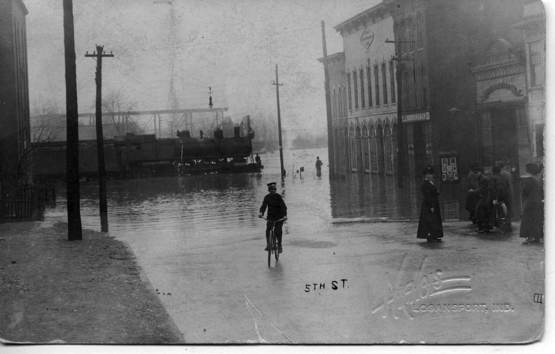
This is the entire photo from which the above was cropped.
Fifth Street, near the RR tracks.

Corner of 4th and E. Market - the northwest corner. Note that a rope
has been stretched for holding onto so one won't get swept away.

E. Market Street

At a glance one would think this was a rescue photo. I did,
until a grandson (Evert Wolfe) of one of the boys pictured here on the back of the wagon
told me that this was more of a "tour group".
They were riding around to see the flood!

This photo was taken on Logansport's west side. It shows the original
Franklin elementary school, which was torn down and a new, modern school built.


Above: at that time North Street went all of the way through to 3rd Street. That block was closed off when the new Cass County Jail was built, so younger generations will not recognize the area.


After...


Downtown merchants tossed damaged goods and furnishings to the street.
For more information go to the Cass County Historical Society web page at casscountyhistory.org you can also do a search for the 1913 flood in Indiana. You could also purchase the book Rain and River through the Cass County Historical Society - all sales benefit the Society.
There is a high water mark on an inside wall at the oldest pub/restaurant in Logansport. It is called Amelio's On The River.
ReplyDelete